Arizona Department of Water Resources will survey wells in parts of Yavapai and Coconino Counties

Graphic 2

PRESS RELEASE

FOR IMMEDIATE RELEASE                                  CONTACT: Doug MacEachern      

March 10, 2017                                                             PHONE: 602.771.8507

Arizona Department of Water Resources will survey wells in parts of Yavapai and Coconino Counties  

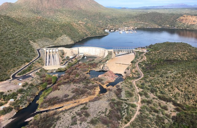
Phoenix- March 10, 2017 – Beginning in early March, the Arizona Department of Water Resources will be making an extensive effort to measure water levels in wells in the Prescott Active Management Area and the Verde Basin (see attached map).

Every year the Department’s field services technicians collect water levels in a statewide network of about 1,600 to 1,800 “index” wells that have typically been measured annually over the last several decades.  There are roughly 250 groundwater index wells measured annually or semi-annually in the Prescott AMA/Verde Basin region.

During the remainder of the 2017 field season Water Resources staff will measure several hundred wells in the Prescott AMA/Verde River basin area in addition to those 250 index wells.

This 2017 survey of area wells – or basin “sweep,” as it is known — will be the first such basin survey of the area since 2009. The data collected will be analyzed and used to obtain a comprehensive overview of the groundwater conditions and used to support scientific and water management planning efforts.

Frequently Asked Questions about basin surveys:

What will the ADWR do with the data?

The department uses the information from the basin survey to develop water level maps to support scientific, planning and management studies of the basin’s aquifer system.

The department produces invaluable “Hydrologic Map Series” reports, and “Water Level Change” reports which show groundwater conditions statewide.

What if well owners don’t want the ADWR measuring their well depth?

Participation and cooperation with the department’s basin survey is entirely voluntary.

The data collected from basin surveys has proved valuable to property owners and lessees just as much as it is to state and municipal water planners.

Why here? And why now?

Historically, the department measures its index wells in the Prescott/Chino Valley/Verde Basin area in the late winter/early spring. During this time, the water levels in the aquifer have typically recovered from the previous summer “pumping” levels and represent a more “static” condition which gives a more representative picture of what’s happening with the aquifers in the area.

Do well owners and lessees get to review the data?

Arizona Department of Water Resources data are all public records. Data collected should be available by early to mid-summer. As maps are completed, the data will be available via the department’s website at azwater.gov. The department’s Groundwater Site Inventory (GWSI) well database is available at: https://gisweb.azwater.gov/waterresourcedata/GWSI.aspx

For more information regarding this matter, please contact Doug MacEachern, Communications Administrator, at dmaceachern@azwater.gov or (602) 771-8507.

###

Seriously? Yes, seriously: Drought-busting moisture levels in parts of the state don’t mean the Arizona drought is done

Record snowfall in the Sierra Nevada…double the average snow in parts of the Rockies… one “atmospheric river” after the next hitting the coast…and enough snowpack in the eastern Arizona mountains to give Lake Roosevelt an outside chance of filling up this spring…yet Arizona remains in drought? Yep


The news is abundant in the West about all the moisture abundance occurring nearly – accent, nearly – everywhere.

Western saturation is the biggest story of the winter in the U.S.

In some areas of northern California, rain totals reached 400 percent of normal in December.  January snowpack in the Sierra Nevada mountains stood at 173 percent of normal, the equivalent of 5.7 trillion gallons of water.

It wasn’t just California experiencing all those remarkably wet atmospheric rivers. As early as mid-January, the Colorado River snowpack stood at 57 percent above the long-term median for that time of year and that was before the big storms of early and late February swept through the Rockies.

Westwide SNOTEL Current Snow Water Equivalent (SWE) Percentage of Normal

The U.S. Department of Agriculture’s latest “Westwide SNOTEL Current Snow Water Equivalent Percentage of Normal” maps of the western mountains are more purple than a ripe eggplant, indicating vast swatches of the region with snowpack deeper than 150 percent of average.

All of which sounds splendid, seemingly alive with drought-busting possibilities… until you have a look at the sobering reality on display in the U.S. Drought Monitor short-term report for February in Arizona.

The February Drought Monitor report may provide the best evidence of the 2016-2017 winter in the Western U.S. for three consistent climate truisms:

  • “Weather” is not the same as “climate,” and
  • Drought is more closely aligned with climate than with weather; and,
  • Drought may come and go in a region, but it comes and goes at different paces in different parts of the same region

The February report concluded: “February was a relatively dry month across parts of the state bringing less than 50 percent of normal precipitation over the eastern third of Arizona and a few spots in northwest Arizona.”

U.S. Drought Monitor – Arizona (February 28, 2017)


Relatively… dry?

This may come as a huge surprise to residents of Maricopa, Yavapai, Coconino, Yuma and La Paz counties, where “much wetter than normal conditions” prevailed. But, then, central Arizona is where most of the residents of the state are too. Most Arizonans were getting wet from the same rainstorm.

It’s a big state. As State Climatologist Nancy Selover notes, the big storms brought plenty of cold air and snow to the northern and western parts of the state, but tended to short-shrift the eastern-mountain watersheds: “They have tended to miss the southeast and many of them have missed the White Mountains as well.”

The headwaters of the Salt and Gila rivers are “below average in snowpack for this time of year,” she said. “Though the Verde is above normal.”

That, Selover observed, is “all short-term drought.”

“We have not had the type of precipitation that will replenish our water resources, so we are not anywhere near being over the drought for long-term water resource concerns.”

Still, said Selover, February overall was “a helpful month” in terms of contributing to the 2017 Water Year profile, which depicts healthy moisture levels since October.

The National Weather Service map of Arizona depicting “Seasonal Precipitation, October 2016 – February 2017” may not  have quite the “ripe eggplant” look as the Western snowpack map, but it’s not far off.

A map of the whole Colorado River Basin rainfall for February and the 2017 Water Year through February map

So where does this mostly-better-than-average winter leave Arizona?

As a part of the Southwestern region? Great: “The Upper Colorado Basin is in great shape this year so far, but we need three or four more consecutive years like this to make up for the deficits,” said the State Climatologist.

But Arizona, specifically? Good, sure. But not great:

“For my money, we are entering the 23rd year (of drought) now,” said Selover.

“I think it started in 1994 after the very wet 1993.”


A water wonderland: Touring Arizona’s mountain watershed by helicopter in a time of moisture abundance

A tour courtesy of Salt River Project of the Salt and Verde watersheds

stewart-mountain-dam

Strictly in terms of aesthetics, it is the perfect time to skim several hundred feet over Arizona’s oldest water-delivery system — the two series of dams and reservoirs operated by the Salt River Project that provide the Valley with its largest supply of in-state surface water.

The air – sparkling and clear between February storms — is satisfyingly crisp. The landscapes are verdant from the abundance of moisture unleashed this winter on Arizona’s mountainsides. It’s poised for a magnificent bloom of spring wildflowers that now is just a week or three away.

Mormon Flat Dam

Eagle pairs are nesting. Wild horses are frolicking in the Salt River. And water is flowing in nearly every wash and cascading down nearly every mountainside.

After years of epic drought and disappointingly dry “El Nino” weather patterns, it is an invigorating moment to be strapped into a Salt River Project helicopter on a mission to examine Arizona’s north-eastern mountain watershed.

From time to time, Arizona’s major water providers guide other state water officials, as well as other groups, on inspection tours of their facilities.  On February 22, SRP led a group of municipal and state water officials, as well as some local journalists, on such a tour.

Putting the trek together were Patricia DiRoss of SRP’s government-relations group; Charlie Ester, manager of the agency’s surface-water resource operations; Josh Robertson of resource planning; and, Evan Hallock of government relations.

They took us up in SRP’s Bell 212 Twin Huey, a heavy-duty workhorse that, among other duties, is used to hoist SRP linemen atop major transmission lines.

The one and a half hour tour traveled northeast from SRP’s east Phoenix facilities, flying first over the Verde River watershed and Bartlett and Horseshoe dams, then southeast to the Salt River system and the oldest and mightiest dam in the SRP system, Roosevelt Dam, which when full can hold back over 1.6 million acre feet of Arizona rainfall and melted snowpack.

The return trip took us over the Salt River system of dams and reservoirs – Horse Mesa Dam… Mormon Flat Dam… and, finally Stewart Mountain Dam and ever-popular Saguaro Lake.

The sights were encouraging.

Both Bartlett and Horseshoe lakes – themselves two of the most popular recreation areas in the state – were effectively full.  Ironically, that abundance of water stored in Bartlett isn’t the best news for campers – there isn’t a lot of shoreline evident for trailers and campers.


Horseshoe Dam

Even in drier years, the Verde watershed produces far more water than the SRP-operated system can hold. System releases are inevitable, and with Bartlett and Horseshoe effectively topped off, the system already is letting water flow toward the Valley.

The releases, which started February 10 at about 500 cubic feet per second, reached as much as 22,000 cfs at the end of the month. While the releases are varying, they are significant enough to make a statement about the abundant rainy season.

The truly encouraging sight on the tour, however, is the condition of Roosevelt Lake. At 35 percent capacity in the middle of December last year, Arizona’s biggest in-state reservoir today is at 60 percent of capacity, a level not seen in six years.


Roosevelt Dam

SRP analysts are calculating that Roosevelt will rise at least to 80 percent of capacity this season if the winter storms continue into March. Indeed, they surmise there is an outside chance the lake will fill up.

Our guide points to the new brickwork on Roosevelt Dam – the water level is just a course or two of bricks below the point where the dam was raised 77 feet in 1996, increasing storage capacity by 20 percent.

“We’re up more than 30 percent since December,” says Ester. “The snow survey we took yesterday indicates there is more snow up there than we’d anticipated. So, as long as we keep getting storms, there is a good chance we’ll fill Roosevelt this year.”

(A career-long SRP employee, Ester recalls that “as a kid,” he would put sticks in water after rainstorms to measure depth: “Who knew that as an adult I’d be doing the same thing?”)

The southwesterly flight back toward Phoenix takes us through the majestic Salt River canyons leading to Horse Mesa, Mormon Flat and, ultimately, Stewart Mountain dams.

It is like a winding river-raft tour through the Grand Canyon – a point not lost on our guide, Ester, who has waterskied on Canyon Lake behind Mormon Flat Dam many times:

“It’s great waterskiing,” he says. “You’d swear you were waterskiing in the Grand Canyon.”

Photos of Bartlett, Horseshoe, Roosevelt and Mormon Flat dams courtesy of William E. Toops, Pueblo Publishers

Senate confirms Zinke as Interior Secretary

The new Zinke team, including appointments to Bureau of Reclamation, will need to learn quickly about the complexities of Colorado River water law and the drought-induced woes facing Lake Mead

zinke-confirmation-photo

By a comfortable 68-31 margin, the U.S. Senate today confirmed President Trump’s nominee for Secretary of the Interior, Ryan Zinke.

The former Montana member of Congress will head a department that manages around 500 million acres of land and waterways in the United States.

Zinke’s department also includes the federal Bureau of Reclamation, the agency responsible for the system of dams and reservoirs on the Colorado River, the waterway that is integral to the livelihood of 40 million U.S. citizens living in the Southwest.

In a statement declaring his approval of the appointment, Arizona Sen. Jeff Flake said he looked forward to working with Zinke’s department, notably on behalf of Arizona’s Colorado River allotment.

“I was pleased to vote to confirm Ryan Zinke for Secretary of the Interior,” said Flake in a statement released shortly following the Senate confirmation.

“Securing the Interior Department’s commitment to honor and protect Arizona water saved in Lake Mead was a major victory for our state’s proactive water conservation efforts.

“I look forward to working with Secretary Zinke to continue this and other policies critical to combatting the drought, preventing a water shortage, and ensuring continued access to Arizona’s share of the Colorado River.”

The new Interior leadership arrives at a critical juncture for the Colorado River system. Despite recent rains and a generally strong mountain snowpack, Lake Mead especially remains perilously close to the point where mandatory supply cuts would be made to protect the reservoir from descending below critical levels.

Zinke’s confirmation opens the door for his own leadership appointments to critical posts with Reclamation, which has direct oversight responsibilities regarding the Colorado system, including Glen Canyon and Hoover dams.


“Fill Mead First” plan to drain Lake Powell has sprung some big leaks, a new assessment finds

Utah State University analysis of proposal finds water savings would be slight and ecological hazards plentiful

lake-mead-viewed-from-arizona

Whether we are talking about draining all of its water or just most of it, reducing  Lake Powell to a secondary status behind Lake Mead would fail in two of the plan’s most important goals, according to a technical assessment released last fall by Utah State University researchers.

One of the primary conclusions of the so-called “Fill Mead First” proposal was that water loss, through evaporation and through reservoir bank storage and seepage into the bedrock below Lake Powell, would be greatly diminished by storing water primarily in Lake Mead.

“Fill Mead First” was developed by the Glen Canyon Institute of Salt Lake City, and enjoys strong backing from environmental groups advocating that the Glen Canyon Dam be decommissioned.

The Utah State assessment, however, found that estimates of water saved from evaporation by effectively combining the two great Colorado River reservoirs were too inaccurate – and data too old – to use them for rendering a sound scientific judgment.

The analysis led by Jack Schmidt, director of Utah State’s Center for Colorado River Studies, found considerable “state of the science” data regarding evaporation at Lake Mead. The work had been performed by the U.S. Geological Survey.

But at Powell, no such research has been conducted since the mid-1970s. What’s more, the USU assessment learned that no studies of water seeping into the relatively porous Navajo sandstone bedrock of Lake Powell had been conducted since the mid-1980s.

Conducting their own research, the Utah State analysts concluded while there may be a slight decrease in evaporation loss by combining the two reservoirs in Lake Mead, the uncertainty of those conclusions appeared too high to base such a huge infrastructure choice – draining Lake Powell – on them.

The Fill Mead First study assumed that reservoir bank storage would remain constant for their analysis period.  The Utah State researchers, however, estimated the bank storage rates have decreased since Lake Powell was completed and therefore the savings would not be significant.  Water in bank storage can return to the reservoir as its elevation drops.

Seepage losses into the Lake Powell bedrock, meanwhile, likely are ten percent of what Fill Mead First advocates claim.  The USU study noted that some of the seepage water returns to the Colorado River above Lee’s Ferry.

Schmidt told Phys.org science-news magazine that it would be best to wait for a better system of data collection and analysis before making any major decisions about the future of Lake Powell.

“The Fill Mead First plan has encouraged us to think broadly about how and where we store water in the Colorado River system,” said Schmidt.

“But the magnitude of potential ecosystem changes caused by the FMF plan are so great and the water savings are so uncertain that implementation should await a new program of data collection and analysis designed to reduce uncertainty about the key process of evaporation and bank seepage.”

Utah State’s findings regarding the ecological consequences of lowering or draining Lake Powell appear even more significant than uncertainty about water losses.

The Fill Mead First proposal would have little effect in its initial phases on the amount of fine-grain sediment released into the Colorado River below Glen Canyon Dam. The plan’s final phase, on the other hand, would “cause significant ecosystem adjustments associated with the sudden change from relatively clear water to a very turbid river.”

The assessment concluded that unless Glen Canyon Dam was bypassed completely, it would be impossible to provide the supply of sand needed to reconstitute the eddy sandbars and camping beaches that today are an important part of the river’s ecosystem throughout the Grand Canyon.

The assessment found that impacts to the river’s aquatic and riparian ecosystem – including the existing population of endangered native species such as the humpback chub – could be “potentially significant.”

Editor’s note: Arizona Water News published a two-part series that began September 29 arguing that the effort to decommission Glen Canyon Dam was ill-advised. That series can be found here. And here.


On Drought and the “Drought Contingency Plan”: A conversation with Water Resources Director Tom Buschatzke about the on-going, multi-state struggle to save Lake Mead

The negotiations to find an equitable way to stabilize the Colorado River system and, specifically, Lake Mead have been underway for nearly four years now.

In some respects, the parties at the table – including representatives of California, Nevada, the federal government and Arizona – largely have found common ground, in principle.

In other respects — notably achieving agreement among the many stakeholders with longstanding, legal claims to water from the Colorado system, as well as the big service providers — a resolution is far less clear.

Tom Buschatzke, director of the Arizona Department of Water Resources, sat down recently to discuss the current status of the much-debated “Drought Contingency Plan” to stabilize Lake Mead, which continues dropping toward critical water levels each year, despite the occasional wet winter, such as this current one.

He also discussed – and defined – the plan that has become known as “DCP Plus” – a plan to permanently assure that no more water is allocated from Lake Mead than flows into it.

As Buschatzke describes, the health of the Colorado River system is critical to Arizona’s future. The system now supplies 41 percent of the state’s water supplies, providing an economic and societal lifeline to millions of residents.

Just what does it take for everyone to get to “yes” in the debate over a fair and equitable Drought Contingency Plan?

In this podcast, Director Buschatzke shares his thoughts on that and much more involving the state’s water resources.

As the director indicates, he remains hopeful. But, as he also makes plain, “hope” is not the same as having a plan.

To listen to this Water Resources podcast, click here.

West Coast facing another ‘atmospheric river’ of weather-related news

Normally, we here at Water Resources prefer to stay off the topic of “weather” and, instead, stick to longer-term climate-related conditions, particularly drought.

The 2016-2017 “water year” — officially October 2016 to September 2017 — isn’t letting us do that. It’s just been too darned wet out there to avoid observing that current weather conditions are greatly impacting long-term climate conditions.

Two big, unavoidable weather stories are happening right now: The “biggest storm of the winter” that is now hitting southern California, and the more northerly disturbance following it that will push a lot of water where none is needed right now, the area of the Oroville Dam.

While the extremely wet Western winter has driven drought off the map in much of northern California, SoCal has been much drier. The sole remaining sliver of “extreme drought” in the Golden State, according to the U.S. Drought Monitor, is in the south.

That status may be changing right now. Greater Los Angeles could get between five and seven inches of rain before the weekend is out. Hundreds of flights out of LAX are being cancelled. And the weekend rush hour commencing in less than two hours is guaranteed to be every traffic cop’s worst nightmare.

The bigger drama, however, remains to the north at the Oroville Dam, where a rain-and-runoff-damaged spillway has caused grave concerns for residents as far downstream as Sacramento.

The latest “atmospheric river” poised to hit northern California is expected late Sunday into Monday and perhaps five inches of rain could fall in the Oroville Dam region. Nevertheless, California Department of Water Resources officials are feeling much better about the dam’s condition than they were just a few days ago.

“The threat level – it is much, much, much lower than what it was on Sunday,” said CDWR Acting Director Bill Croyle to reporters on Thursday.

The Oroville crisis prompted some considerable interest among local media about the condition of Arizona dams.

As ADWR Director Tom Buschatzke explained to ABC News 15 earlier this week, Arizona’s biggest dams — including the two mega-dams on the Colorado River and the Salt River Project dams — are inspected by the federal Bureau of Reclamation.

The ADWR dam-safety program regularly inspects 106 dams designated as “high-hazard potential” dams around the state, but none of which approaches the size of the 770-foot Oroville Dam, or the 3.5 million acre feet of water held behind it.

SNOWPACK IN THE ROCKIES: Hey, it’s not ALL about California!

It’s still early, but much of Arizona’s watershed, as well as the western face of the Rockies, is experiencing higher-than-normal precipitation, too


rocky-mountains-in-winter

Nothing against California, you understand. We’re all delighted to hear about this winter’s bounty of rain and snow, especially as it piles high in the Sierra Nevada.

Love all those “atmospheric rivers.”

It is great to hear of expert-level debates over whether the Golden State’s drought designations should be eased — or even lifted entirely — especially in the north of the state.

There are parts of the mountains immediately east of Sacramento and San Francisco that have experienced well over 200 percent of the official average precipitation. As they say in southern Cal: Whoa!

But, well… it’s not all about California, you know.

According to data compiled and analyzed by the National Water and Climate Center, precipitation thus far in the “water year” – that is, the period beginning October 1, 2016 – has been predominately “near to well above average” almost everywhere in the West, except Alaska.

Meanwhile, the snowpack in the southern regions of the Western U.S. – the areas of the West most seriously impacted by record and near-record drought – is being judged “well above average,” according to the results reported in the Water and Climate Center’s Snow Telemetry (SNOTEL) summaries.

That snowpack translates, ultimately, into the statistics that matter most to the 35 million-odd people living in the Colorado River basin: the streamflow forecasts and the expectations for reservoir storage levels. And those are looking better than they have in a long time too:

The SNOTEL measurements depict “well above average streamflow in the middle and southern parts of the West,” and reservoir storage amounts that should be “above average in Montana and Wyoming, near average in Colorado and Nevada.”

As of February 1, the Center is forecasting inflows into Lake Powell at 147 percent of the 30-year average for April through July, a critical streamflow period.

Almost… California-esque.

For Arizona specifically, the precipitation picture has brightened considerably this winter.

“We have to go all the way back to 2010 the last time we filled the reservoirs,” said Salt River Project water operations manager Charlie Ester to 12News on February 2.

“In the seven years since then, we have progressively lowered the reservoirs to the current conditions.”

With much of Arizona’s water supply beginning its annual journey on the western slopes of the Colorado Rockies, the Water and Climate Center’s early February report is promising. January produced 217 percent of normal precipitation in Colorado, and the February 1 snowpack is at 156 percent of normal, up 43 percent from January.

As a result, streamflow forecasts “are nearly all above normal with the western basin projections providing the highest forecasts,” according to the Water and Climate Center report.

Even in the best of times, precipitation never distributes evenly.

As of February 1, the “snow-water equivalent levels” – that is, the amount of liquid, flowing water expected to be produced from a region’s snowpack – range from 88 percent of median in the San Francisco-Upper Gila River Basin to 166 percent of median in the Verde River Basin.

Still: “Cumulative precipitation since October 1 is now well above normal in all major river basins for the water year.”

Precipitation disclaimers in the arid Southwest are always lit bright, however. The remarkable measurements of the winter to date are entirely capable of petering out to nil. Which is a pretty good summary of how last winter went.

A winter’s precipitation is the result of weather. And while drought is a function of weather over time, it isn’t something that disappears in a single, wet season.

The effects of drought, for example, can be cumulative. The volume of Southwestern desert dust that blows east onto the western slopes of the Rockies has been shown to have a cumulative effect on the duration of the winter season.

NOAA’s Cooperative Institute for Research and Environmental Sciences at the University of Colorado Boulder, for example, reported in late 2013 that the snowpack of the Rockies “is melting out as many as six weeks earlier than it did in the 1800s,” as a result of a thick layer of desert dust.

It’s not just drought that impacts Colorado River streamflow, in other words.

Moisture at these levels in the West can make people forget quickly the long-term issues the region faces. Already, Californians are in a fierce debate over whether to extend Gov. Jerry Brown’s emergency drought declaration and whether or not to ease up on other water-conservation efforts.

“Most water agencies have yet to adjust to this ‘new normal’ and are operating on outmoded assumptions and practices that place the state at risk of water shortages and worse,” argued climate-change expert Alex Hall of UCLA in a commentary that appeared February 5 in the Los Angeles Times.

Hall’s concern – that the recent snow and rain will blunt efforts to improve water-use efficiencies in southern California – is a concern for the entire Southwest.

Could this one year’s abundance blunt efforts to resolve the systemic over-allocation of Colorado River water, for example?

If there is a downside to the current – and literal – flood of moisture into the region, it is that.

“While I’m happy about all the snow,” said Water Resources Director Tom Buschatzke, “we don’t have enough certainty about what Mother Nature is going to send us.

“We have to focus on what we have control of.”


Water Resources director hails agreement to expand uses of CAP canal system

“System-use agreement” between Central Arizona Project and the federal Bureau of Reclamation a major milestone for vital water-delivery system

Central Arizona Project photo by Philip A. Fortnam
Central Arizona Project board President Lisa Atkins and board member Sharon Megdal signing the CAP System Use Agreement on Feb. 2


Central Arizona Project and the federal Bureau of Reclamation reached an historic agreement on Thursday that allows for “new and innovative” uses of the CAP’s 336-mile system of canals, including transporting new water supplies, exchanging supplies among users and efficiently accessing water stored underground by the Arizona Water Banking Authority and others.

The agreement creates a legal framework for a variety of water supplies to be moved through the system, including many dedicated to addressing possible future shortfalls in Arizona’s Colorado River water allocations.

“It allows for flexibility in managing our Colorado River water supplies,” said Tom Buschatzke, director of the Arizona Department of Water Resources.

Until now, so-called “non-CAP water” – that is, water controlled by users other than the Central Arizona Project – flowed through the elaborate delivery system only on an ad hoc basis.  In 2014, for example, the cities of Phoenix and Tucson reached an agreement allowing Phoenix to store some of its unused Colorado River allocation in Tucson-area aquifers.

Thursday’s agreement provides a legal framework for such water exchanges, thus opening the door for further innovation, as well as for future agreements on water quality and financial issues.

CAP General Manager Ted Cooke also noted the additional flexibility that the agreement provides his agency. Cooke thanked the agencies involved in helping make it happen for their collaborative efforts:

“This agreement provides us with the flexibility for cost-effective recovery of stored water, including more than four million acre-feet of CAP water stored in the aquifers of central and southern Arizona,” said Cooke.

“I would like to thank the negotiators from the Department of the Interior and the Bureau of Reclamation, along with the significant contributions from the Arizona Department of Water Resources and the Arizona Water Banking Authority.”

Water Resources Director Buschatzke joined Cooke in extending thanks to the Arizona congressional delegation – especially noting the efforts of Arizona Senator Jeff Flake – for helping make the system use agreement happen.

“Our role was to support efforts to complete the system use agreement for the benefit of Arizona water users,” added Buschatzke.

“We sought to support the maximum flexibility of this important asset.”

Gov. Doug Ducey expressed thanks to former Interior Secretary Sally Jewell for her efforts in support of the system-use agreement.

The CAP canal system was built by the federal Bureau of Reclamation for the state of Arizona and is managed and operated by the Central Arizona Project.

The deal is especially valuable to the Water Bank, which pays to bring Colorado River water through the CAP system into central and southern Arizona. The Water Bank stores that water in underground aquifers, or directly recharges it into underground storage facilities. It also arranges for water deliveries to irrigation districts, which use the water in lieu of mined groundwater.

Water Bank officials helped review the agreement.

The deal creates a legal framework allowing the Water Bank to use the CAP system to make recovered water available during potential periods of shortage of Colorado River water deliveries to Arizona. Until now, the Water Bank’s capacity to make use of the water it stores has been extremely limited.

 (A Central Arizona Project statement released Thursday contributed to this blog post)


Arizona Senator Jeff Flake tabbed to head drought-crucial Water & Power subcommittee

New chairman cites leadership on protecting Lake Mead as key duty

flake-at-az-national-league-of-cities-event-last-year
Arizona Senator Flake at an Arizona League of Cities event


Arizona Senator Jeff Flake, who in July won assurances that water stored in Lake Mead would be retained by Arizona, has been named chairman of the Senate Energy and Natural Resources Subcommittee on Water and Power.

The new chairman’s subcommittee is responsible for overseeing federal involvement in a wide swath of water matters of substantial importance to Arizona and the Southwest.

 The jurisdiction of the panel includes agricultural irrigation, reclamation projects, power marketing administrations, energy development impacts on water resources, groundwater resources and management, hydroelectric power and other energy-and-water related concerns.

The senator, moreover, said in a statement that he would use his chairmanship to safeguard his home state’s water supplies

 “I look forward to using this chairmanship to improve stewardship of Arizona’s water and energy resources,” said Flake.

“Whether it’s strengthening oversight at (the Western Area Power Administration), protecting Arizona’s voluntary water contributions to Lake Mead, or taking proactive steps to prevent a drought declaration in Arizona, I will actively work with my colleagues on the Water and Power Subcommittee to hold federal agencies accountable.”

Last summer, Flake received a written assurance from the US Department of the Interior that Colorado River water stored by Arizona users in Lake Mead to maintain higher levels would not subsequently be released to other states, notably California.

Flake said at the time that his lengthy negotiations with California Senator Dianne Feinstein to improve inter-state cooperation on protecting Lake Mead was successful. Among other considerations, California water officials had become “more receptive” to Arizona’s water concerns as a result of his negotiations with Senator Feinstein.

Senator Flake at Lake Mead
 An amendment package submitted by Flake and Arizona Sen. John McCain to the Feinstein legislation in September also figured in the legislation, which passed in the fall.

The Flake/McCain amendment directed that a study be performed by the National Academy of Sciences on how to best control water-intensive invasive species like tamarisk, also known as salt cedar. It also required that the Interior Department create an implementation to put the study’s recommendations into action.

A federal report issued last August indicating a probable 2018 shortfall declaration affecting Colorado River water users also helped prompt negotiations.

“They’re more receptive than ever now that there is a potential shortage to be declared,” Flake said. “It’s something that draws people together.”

Flake is a fifth-generation Arizonan who was first elected to the U.S. Senate in 2013. Prior to that he served in the U.S. House of Representatives from 2003 to 2013.