Historically dry winter means Lake Mead may be closer to shortfall than people think

Dry Rockies

LAKE MEAD SHORTFALL AS SOON AS 2019? DON’T WRITE IT OFF

A Q&A WITH THE ADWR DIRECTOR ABOUT POTENTIAL CONSEQUENCES OF AN HISTORICALLY LOW SNOWPACK IN THE ROCKIES

In case you hadn’t noticed, we’ve had some beautiful warm, sunny, dry days of late.

And weeks. And months. The entire Southwest, in fact, has experienced one of the warmest, driest winters on record. For golfing and hiking and living the outdoor lifestyle, that’s great, of course. But, alas, there is an unsettling flip side to all this fair weather.

That dark flip side is the possibility of an unprecedented lack of snowpack runoff in the Colorado River system. Forecasts are calling for a continuation of the dry weather into the fast-approaching spring.

Winter – typically the Southwest’s season for accumulating snowpack in its mountain regions, which provides runoff into reservoirs like Lake Powell and Lake Mead – is nearing its end, regardless what groundhogs in Pennsylvania claim.

Arizona Water News recently sat down with Tom Buschatzke, Director of the Arizona Department of Water Resources, to discuss the consequences of what may be a record-low amount of runoff into the Colorado River system from the 2017-2018 Winter snowpack.

A transcript of that conversation follows:

Arizona Water News: Director Buschatzke, there is a concern that the lack of snowpack in the western Rockies – particularly in the southern sectors of the Rockies – may result in an unregulated runoff into Lake Powell this spring that may be at a record low. How real is that possibility?

Tom Buschatzke: Based on the current snow-water equivalent graphs, regarding that snow-water equivalent in the upper basin of the Colorado River where most of that water is generated is a very real possibility that the snow-water equivalent is tracking lower than 2002, which was the lowest year in recorded history for 100 years of records.

We do know that the runoff is not linear to what the snow-water equivalent is showing, but it is pretty alarming that we are tracking at this point 2002, or actually a little bit below 2002.

AWN: The Bureau of Reclamation has declared that there is almost no chance of a shortfall in water delivered from Lake Mead next year. But is there a chance that those predictions may change as a result of these extremely dry conditions in the Rockies?

TB: Yes, there is certainly a chance that that that prediction, that forecast, may change.

That forecast is based on a release from Lake Powell to Lake Mead of 9 million acre-feet. Normal release is 8.23 million acre-feet. If the unregulated inflow gets to a certain low level, that 9 million acre-feet release won’t occur. You will get 8.23 million acre-feet.

That loss of volume of water (represents) close to 10 feet of elevation in Lake Mead. The Bureau of Reclamation’s current projection — with that 9 million acre-foot release — is about five feet above the shortage trigger, which means that if we get 8.23 (million acre-feet), we could be five feet below the shortage trigger.

If we can’t conserve enough water in Lake Mead to make up the difference, that will be a high bar to achieve between mid-April and the end of July, which would be the time period in which we’d have to do that conservation.

AWN: We’re not the only ones experiencing an abnormally dry winter. California’s snowpack in the Sierra Nevada also is very low right now too. How might that impact California’s stored water in Lake Mead?

TB: If the snowpack in the Sierra Nevada continues to be also very low and the allocations of the State Water Project remain very low, that means southern California is going to get much less water from northern California than it normally does. It also means that they will be looking to make up the difference somehow, and they will be looking probably at the Colorado River to make up that difference.

Potentially, some of that water stored by California – by the Metropolitan Water District (of Southern California), particularly – that is stored in Lake Mead might start coming out of Lake Mead.

There is about 500,000 acre-feet of that water stored. That is over six feet of water under the regulations that control water going in and water going out of Lake Mead. California can take 400,000 acre-feet – or five feet of water (off the top of Lake Mead) – in this calendar year. So, that is a potential that plays into the possibility that the prediction made by Reclamation so far might also change.


AWN: How does the unusually dry winter affect the discussion among the Colorado River states regarding a Drought Contingency Plan? Many Colorado River stakeholders felt that last winter’s higher-than-average snowpack created a so-called “comfort zone” regarding finalizing a DCP. Can they remain comfortable about water in the Colorado now?

TB: So, I think between the states — the state folks who worked on that Drought Contingency Plan – we are in agreement that we need to finalize that Plan.

Some of the individual stakeholders, water-users, etc. that may have believed that there is a “comfort zone,” that we have bought time to further work on the Drought Contingency Plan, I think, need to really address what is happening with the hydrology and the increasing risks of not just the short-term impacts on Lake Mead, but potentially going into a shortage in 2019.

(They need to address the fact that) this bad hydrology also has implications for the future and for the lake falling to those critical elevations that the Drought Contingency Plan was intended to protect.

So, they should not be comfortable about water in the Colorado River. We need to continue to work to finalize the Drought Contingency Plan. And we need to make sure that in Arizona we have the tools in place to make that happen.

AWN: Thank you.

Attack of the Blob: How an enormous, persistent arctic low-pressure system is helping dry out the American Southwest

Article_banner_1

It’s… the blob. It came from above. And it’s got the world in its grip.

And… it’s not going anywhere any time soon.

If that sounds like a trailer line for a low-budget sci-fi movie… well, it could be.

But it also fairly describes the powerful “Strong Hudson Bay Low” – an Arctic-spawned low-pressure systemthat locked in place over much of the Northern Hemisphere in mid-November. The strong, static “blocking” system is showing no sign of releasing its grip any time in the foreseeable future.

“WITH SNOW CONDITIONS IN THE UPPER COLORADO RIVER BASIN TRACKING AT JUST 31 PERCENT OF THE TOTAL AVERAGE SEASONAL ACCUMULATION AS OF MID-JANUARY, THE 2018 SEASON IS LOOKING DRYER THAN THE RECORD-DRY 2002 SEASON.”

And neither is one of the stronger regional effects of the huge low-pressure system:

An equally persistent, equally strong high-pressure ridge has locked into place beneath the blob. It sits in an equally unyielding “blocking” pattern over the eastern Pacific and the southwestern U.S., which is driving the west-east jet stream and its storms well to the north of the parched American Southwest.

That strong high-pressure system is proving to be a virtual mirror image of the Strong Hudson Bay Low, driving temperatures dramatically up and sapping the atmosphere of moisture.

“How strong and permanent it becomes depends on establishment of other high- and low-pressure systems as well as the amplitude of the jet stream around the globe,” explained Greg Smith, a senior hydrologist at the Colorado Basin River Forecast Center, a division of the National Weather Service and the National Oceanic and Atmospheric Administration.

Coming at the time of year when the western slopes of the Rocky Mountains typically build snowpack that, come spring, provides run-off into the Colorado River system, the moisture-robbing effects of this static high-pressure system may prove to be record-setting.

So too might the effects of the Artic blob.

On January 2 in the U.S., at least one location in all 50 states recorded temperatures below freezing. Yes, even in Hawaii.

Water fountains in Florida froze over. Off-shore, sharks swimming near Cape Cod froze to death. And all that occurred before the infamous “bomb cyclone” drove temperatures deeply negative on the entire East Coast for nearly a week.

On the opposite side of the globe, meanwhile, it’s the same deal. The Arctic blob has much of the eastern side of the Northern Hemisphere frozen and snow-bound, too.

In Yakutia, Siberia – 3,300 miles east of Moscow – residents reported their eyelashes freezing as temperatures dropped to an astonishing 88 degrees below zero Fahrenheit. In southwestern Scotland — typically cold and wet in the winter — blizzard conditions shut down highways. And shipping on the normally blue Danube – for now, icy gray – was halted because of ice.

All weather patterns being inter-related with all other weather patterns, the powerful high-pressure ridge sitting over much of the southwestern U.S. built up around the same time as the Strong Hudson Bay Low gathered its global steam – in mid-November.

And like its Hudson Bay “polar” opposite, there it has remained. And remained. Strong. Resolute. And dry.

While neither strong low-pressure systems that sweep down from the Arctic nor high-pressure ridges laying out over the western U.S. are unusual at this time of year, these systems are unique in one important respect: their persistence. They won’t quit.

The high-pressure ridge has proved so persistent – and the conditions it creates so dry – that hydrologists at the Forecast Center now are comparing this season’s snowpack in the Rockies (as well as in the Arizona mountains) to that of the infamously dry winter of 1976-1977, which produced one of the lowest inflows into Lake Powell on the Colorado River system on record.

How low did that inflow go?

The fall-winter “water year” season that ended in 1977 produced an unregulated Colorado River inflow into Lake Powell of roughly 5.8 million acre-feet. That is almost three million acre-feet less than the average river flow into Powell since 2000, a period when much of the Southwest, including Arizona, has been locked in chronic drought.

Measured against the historic average since 1964, the 1977 inflow into Powell was almost five million acre-feet below average. Since 1964, only three seasons have provided less runoff than 1977.

“What drew us to the comparison (with 1977) initially was the snow situation,” said Smith.

The Forecast Center’s highly advanced “SNOTEL” (for “snow telemetry”) network indicated that many of the Colorado River Basin’s snowpack areas, especially in the southern regions, were experiencing the “lowest snow on record,” according to Smith.

To Smith and other hydrologists, the atmospheric patterns prompting the weak snowpack seemed familiar:

“Some of us recall how poor conditions were in 1976-77. Then we noticed these large atmospheric features — strong low in the east and ridge in the west — were similar.”

Added Smith: “These are not uncommon features from year to year. But in both 1976-1977 and this year they were fairly strong, and the jet stream flow in the atmosphere similarly had a high amplitude. These strong low- and high-pressure systems, known as blocking features, or a blocking pattern, can be quite stubborn.”

As it stood in mid-January, the estimate for unregulated inflow into Lake Powell from the western slopes of the Rockies indicated the lake would receive 6.75 million acre-feet of runoff, or 62 percent of the historic, 30-year average. Not good, obviously. But not historically bad.

That estimate may be changing, however. And not for the better.

The lowest Colorado River inflow into Powell ever recorded was about 2.3 million acre-feet in 2002.

With snow conditions in the Upper Colorado River basin tracking at just 31 percent of the total average seasonal accumulation as of mid-January, the 2018 Water Year season – at this point in time — is looking dryer than the record-dry 2002 season.

A “snapshot” chart recently released by the federal Bureau of Reclamation compares the current water-year snow conditions with Water Year 2002. As of January 17, which is 57 percent through the snow-accumulation season, snow conditions were tracking well below conditions in 2001-2002.

Caveats apply, certainly.

Weather changes. The “blocking” low- and high-pressure systems could weaken and dissipate. And we are still relatively early in the snow-accumulation season. The very dry mid-January snapshot of conditions could look very different by mid-February.

As Smith notes, the 1976-1977 pattern finally broke down in March 1977, ushering in a much wetter late-winter period, especially in the northern Colorado and Great Basins.

As our days of unnervingly pleasant sunshine and annoyingly dry, easy breezes drone on – and on – the prospects for matching (or, gulp, “besting”) the Great Colorado River Dribble of 2002 increase.

But, again, as the forecasters well know, weather changes. Even the extraordinarily dry winter of 1977 ended pretty wet.


Feds now see Lake Mead levels sinking 20 feet lower by ‘19 than predicted just last month


Mead

The sensational news about record-setting snowpack in the Sierra Nevada of California and “atmospheric rivers” delivering over 1,000 percent of normal winter rainfall to Big Sur has disguised a much less-than-sensational record of winter moisture elsewhere in the West.

The winter snowpack on the western slopes of the Rockies – the source moisture for the Colorado River – is producing much less runoff than had been anticipated.

As a result, the federal Bureau of Reclamation now is predicting that Colorado River releases from Lake Powell into Lake Mead will be far lower than what the Bureau had anticipated in March of this year.

Indeed, the Bureau now is predicting a huge drop in Lake Mead inflows from those predicted just a month ago.

According to BOR’s June 24-Month Study , projected flows into Lake Mead most likely will result in water levels 20 feet lower on January 1, 2019 than the Bureau had estimated in its 24-Month Study released in May.

The May 24-Month Study prepared by BOR (based on the Colorado River Basin Forecast Center’s water supply forecast) concluded that on January 1, 2019, Lake Mead’s depth likely would be 1,096.77 feet.

Just one month later, the Bureau now is projecting Lake Mead’s surface level on that date at 1,076.53 feet, literally inches above the level that would trigger automatic delivery cutbacks, mostly to central Arizona’s allotment of Colorado River water.

The dramatic turn-around in anticipated water flow into Lake Mead is a direct result of disappointing expectations for water flow into Lake Powell upstream. Powell’s diminished inflows are due to a dry early spring and consistently warmer-than-average temperatures in the Rocky Mountain region through the spring.

The sudden drop-off of moisture in the wake of an extremely wet January and February was “the big game-changer,” said Jeff Inwood of the Arizona Department of Water Resources’ Colorado River Team.

“The spring snows stopped and it got warmer faster, so lots of the snowpack melted off.”

The severe drop-off in anticipated flows into Lake Mead represents a shocking turn-around in expectations for the near-term health of the great reservoir.

Scarcely more than a month ago, most water analysts were breathing a sigh of relief in the wake of years of drought and diminished Rocky Mountain snowpack.

Improved moisture levels this past winter, they believed, had pushed back a Day of Reckoning for Lake Mead. Better-than-average winter snows would prompt water releases from Lake Powell that would raise Mead levels above critical stages.

The anticipation of relief was so palpable, in fact, that some Arizona water users and managers began to believe that the state would have more time to deal with the “Drought Contingency Plan – Plus,” the intra-Arizona plan that, once approved, would spread water-delivery cuts among a wider swath of Arizona water users.

In fact, as recently as March, some analysts were talking openly of a possible “equalization” release this year from Lake Powell to Lake Mead – a comparatively enormous release of water, perhaps of more than 11 million acre-feet. John Fleck, the Water Resources Program director at the University of New Mexico, calculated in mid-March that if the heavy winter moisture held, Lake Mead “would rise 27 feet this year.” 

Fleck added that “it probably won’t” hold. And he was right. The June 2017 24-Month Study results have made that prediction official: the big 2017 water balloon now appears to have burst.

Modeling conducted by the Bureau in addition to the 24-Month Study in April indicated that there remained a 45% probability of Lake Powell operating in the Equalization Tier with a release from Lake Powell of greater than 8.23 MAF in 2018.

In March, water analysts were predicting a very healthy 10.4 million acre-feet inflow into Lake Powell off the Rocky Mountain watershed during the critical April-July runoff season.

Now? Updated June statistics indicate inflows to Lake Powell of just 8.3 million acre-feet, a drop-off of over 2 million acre-feet — more than the entire annual delivery of the Central Arizona Project’s allotment for its Maricopa, Pinal and Pima County customers.

“We’ve seen this before,” said Water Resources Director Tom Buschatzke, noting that some of the region’s driest winter seasons started out with hope-inspiring bursts of moisture. “We saw it as recently as 2012 and 2013.”

“Recent scientific studies have been predicting this would be more of what we could expect to see in the future,” Buschatzke said.

The diminished expectations of water flowing into Lake Powell directly impact expectations for the health of Lake Mead in the coming years.

The Bureau of Reclamation’s data analysis indicate that on January 1, 2018 – the period during which heavy Lake Powell releases were expected to give Colorado River water officials a “breather” – Lake Mead’s water level likely will be at just 1,080.49 feet, barely more than five feet above the shortage trigger of 1,075 feet.

The primary driver of those lower lake levels is the diminishing amount of water to be released from Lake Powell – down from an anticipated “equalization release” of 10.8 million acre-feet during Water Year 2018, as reported in May, to a “balancing release” of just 9.0 million acre-feet, as reported by the Bureau in June.

“Fill Mead First” plan to drain Lake Powell has sprung some big leaks, a new assessment finds

Utah State University analysis of proposal finds water savings would be slight and ecological hazards plentiful

lake-mead-viewed-from-arizona

Whether we are talking about draining all of its water or just most of it, reducing  Lake Powell to a secondary status behind Lake Mead would fail in two of the plan’s most important goals, according to a technical assessment released last fall by Utah State University researchers.

One of the primary conclusions of the so-called “Fill Mead First” proposal was that water loss, through evaporation and through reservoir bank storage and seepage into the bedrock below Lake Powell, would be greatly diminished by storing water primarily in Lake Mead.

“Fill Mead First” was developed by the Glen Canyon Institute of Salt Lake City, and enjoys strong backing from environmental groups advocating that the Glen Canyon Dam be decommissioned.

The Utah State assessment, however, found that estimates of water saved from evaporation by effectively combining the two great Colorado River reservoirs were too inaccurate – and data too old – to use them for rendering a sound scientific judgment.

The analysis led by Jack Schmidt, director of Utah State’s Center for Colorado River Studies, found considerable “state of the science” data regarding evaporation at Lake Mead. The work had been performed by the U.S. Geological Survey.

But at Powell, no such research has been conducted since the mid-1970s. What’s more, the USU assessment learned that no studies of water seeping into the relatively porous Navajo sandstone bedrock of Lake Powell had been conducted since the mid-1980s.

Conducting their own research, the Utah State analysts concluded while there may be a slight decrease in evaporation loss by combining the two reservoirs in Lake Mead, the uncertainty of those conclusions appeared too high to base such a huge infrastructure choice – draining Lake Powell – on them.

The Fill Mead First study assumed that reservoir bank storage would remain constant for their analysis period.  The Utah State researchers, however, estimated the bank storage rates have decreased since Lake Powell was completed and therefore the savings would not be significant.  Water in bank storage can return to the reservoir as its elevation drops.

Seepage losses into the Lake Powell bedrock, meanwhile, likely are ten percent of what Fill Mead First advocates claim.  The USU study noted that some of the seepage water returns to the Colorado River above Lee’s Ferry.

Schmidt told Phys.org science-news magazine that it would be best to wait for a better system of data collection and analysis before making any major decisions about the future of Lake Powell.

“The Fill Mead First plan has encouraged us to think broadly about how and where we store water in the Colorado River system,” said Schmidt.

“But the magnitude of potential ecosystem changes caused by the FMF plan are so great and the water savings are so uncertain that implementation should await a new program of data collection and analysis designed to reduce uncertainty about the key process of evaporation and bank seepage.”

Utah State’s findings regarding the ecological consequences of lowering or draining Lake Powell appear even more significant than uncertainty about water losses.

The Fill Mead First proposal would have little effect in its initial phases on the amount of fine-grain sediment released into the Colorado River below Glen Canyon Dam. The plan’s final phase, on the other hand, would “cause significant ecosystem adjustments associated with the sudden change from relatively clear water to a very turbid river.”

The assessment concluded that unless Glen Canyon Dam was bypassed completely, it would be impossible to provide the supply of sand needed to reconstitute the eddy sandbars and camping beaches that today are an important part of the river’s ecosystem throughout the Grand Canyon.

The assessment found that impacts to the river’s aquatic and riparian ecosystem – including the existing population of endangered native species such as the humpback chub – could be “potentially significant.”

Editor’s note: Arizona Water News published a two-part series that began September 29 arguing that the effort to decommission Glen Canyon Dam was ill-advised. That series can be found here. And here.


SNOWPACK IN THE ROCKIES: Hey, it’s not ALL about California!

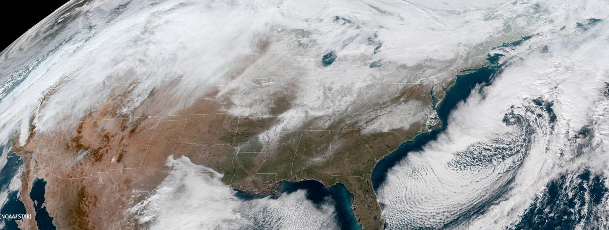
It’s still early, but much of Arizona’s watershed, as well as the western face of the Rockies, is experiencing higher-than-normal precipitation, too


rocky-mountains-in-winter

Nothing against California, you understand. We’re all delighted to hear about this winter’s bounty of rain and snow, especially as it piles high in the Sierra Nevada.

Love all those “atmospheric rivers.”

It is great to hear of expert-level debates over whether the Golden State’s drought designations should be eased — or even lifted entirely — especially in the north of the state.

There are parts of the mountains immediately east of Sacramento and San Francisco that have experienced well over 200 percent of the official average precipitation. As they say in southern Cal: Whoa!

But, well… it’s not all about California, you know.

According to data compiled and analyzed by the National Water and Climate Center, precipitation thus far in the “water year” – that is, the period beginning October 1, 2016 – has been predominately “near to well above average” almost everywhere in the West, except Alaska.

Meanwhile, the snowpack in the southern regions of the Western U.S. – the areas of the West most seriously impacted by record and near-record drought – is being judged “well above average,” according to the results reported in the Water and Climate Center’s Snow Telemetry (SNOTEL) summaries.

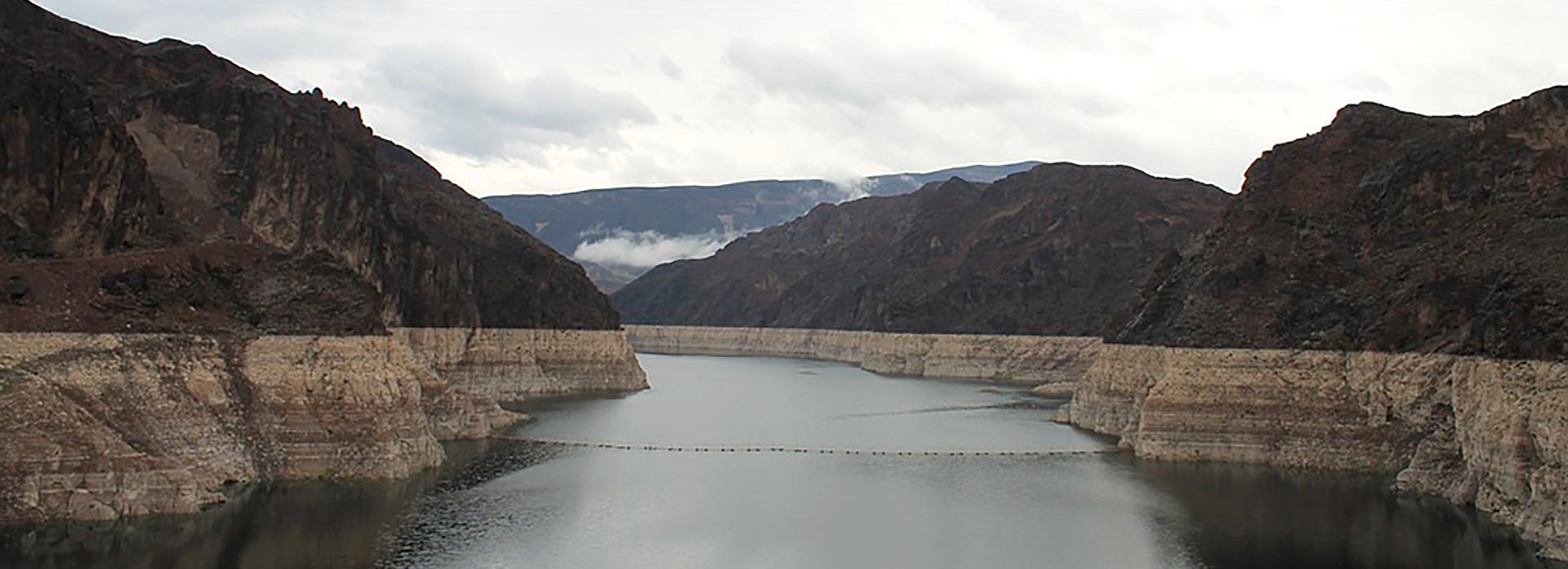
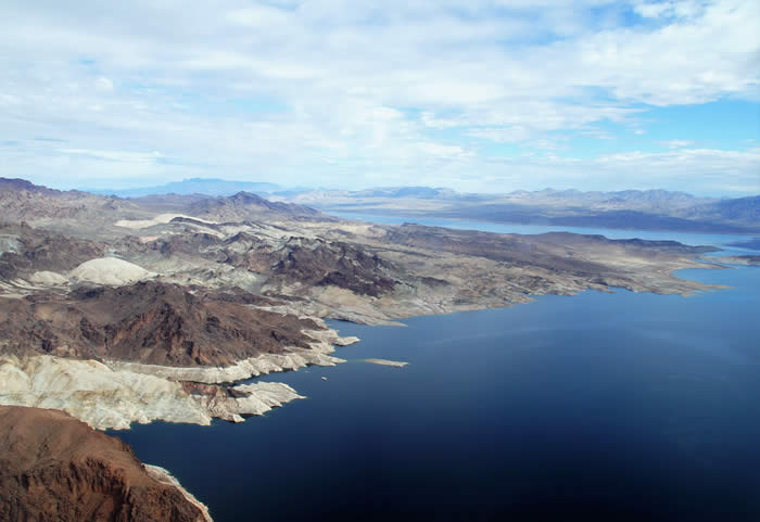
That snowpack translates, ultimately, into the statistics that matter most to the 35 million-odd people living in the Colorado River basin: the streamflow forecasts and the expectations for reservoir storage levels. And those are looking better than they have in a long time too:

The SNOTEL measurements depict “well above average streamflow in the middle and southern parts of the West,” and reservoir storage amounts that should be “above average in Montana and Wyoming, near average in Colorado and Nevada.”

As of February 1, the Center is forecasting inflows into Lake Powell at 147 percent of the 30-year average for April through July, a critical streamflow period.

Almost… California-esque.

For Arizona specifically, the precipitation picture has brightened considerably this winter.

“We have to go all the way back to 2010 the last time we filled the reservoirs,” said Salt River Project water operations manager Charlie Ester to 12News on February 2.

“In the seven years since then, we have progressively lowered the reservoirs to the current conditions.”

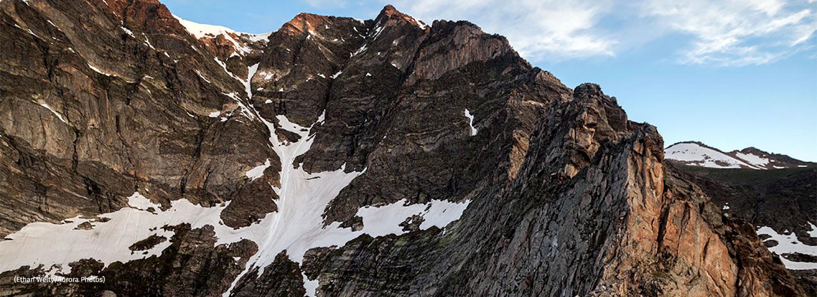
With much of Arizona’s water supply beginning its annual journey on the western slopes of the Colorado Rockies, the Water and Climate Center’s early February report is promising. January produced 217 percent of normal precipitation in Colorado, and the February 1 snowpack is at 156 percent of normal, up 43 percent from January.

As a result, streamflow forecasts “are nearly all above normal with the western basin projections providing the highest forecasts,” according to the Water and Climate Center report.

Even in the best of times, precipitation never distributes evenly.

As of February 1, the “snow-water equivalent levels” – that is, the amount of liquid, flowing water expected to be produced from a region’s snowpack – range from 88 percent of median in the San Francisco-Upper Gila River Basin to 166 percent of median in the Verde River Basin.

Still: “Cumulative precipitation since October 1 is now well above normal in all major river basins for the water year.”

Precipitation disclaimers in the arid Southwest are always lit bright, however. The remarkable measurements of the winter to date are entirely capable of petering out to nil. Which is a pretty good summary of how last winter went.

A winter’s precipitation is the result of weather. And while drought is a function of weather over time, it isn’t something that disappears in a single, wet season.

The effects of drought, for example, can be cumulative. The volume of Southwestern desert dust that blows east onto the western slopes of the Rockies has been shown to have a cumulative effect on the duration of the winter season.

NOAA’s Cooperative Institute for Research and Environmental Sciences at the University of Colorado Boulder, for example, reported in late 2013 that the snowpack of the Rockies “is melting out as many as six weeks earlier than it did in the 1800s,” as a result of a thick layer of desert dust.

It’s not just drought that impacts Colorado River streamflow, in other words.

Moisture at these levels in the West can make people forget quickly the long-term issues the region faces. Already, Californians are in a fierce debate over whether to extend Gov. Jerry Brown’s emergency drought declaration and whether or not to ease up on other water-conservation efforts.

“Most water agencies have yet to adjust to this ‘new normal’ and are operating on outmoded assumptions and practices that place the state at risk of water shortages and worse,” argued climate-change expert Alex Hall of UCLA in a commentary that appeared February 5 in the Los Angeles Times.

Hall’s concern – that the recent snow and rain will blunt efforts to improve water-use efficiencies in southern California – is a concern for the entire Southwest.

Could this one year’s abundance blunt efforts to resolve the systemic over-allocation of Colorado River water, for example?

If there is a downside to the current – and literal – flood of moisture into the region, it is that.

“While I’m happy about all the snow,” said Water Resources Director Tom Buschatzke, “we don’t have enough certainty about what Mother Nature is going to send us.

“We have to focus on what we have control of.”