

PHOENIX- Beginning the week of March 3, 2025, and continuing through April 2025, Arizona Department of Water Resources (ADWR) field services staff will make an extensive effort to measure water levels in wells within several groundwater basins in Southern Arizona. This survey of wells – or basin “sweep”, as it is known, was last conducted during the Spring of 2020.
The data collected will be analyzed and used to obtain a comprehensive overview of the groundwater conditions and used to support scientific and water management planning efforts. Among others, data uses will include:
- Analysis of water-level trends
- Groundwater modeling
- Water-level change maps
- Hydrologic reports
- Water resource planning and management
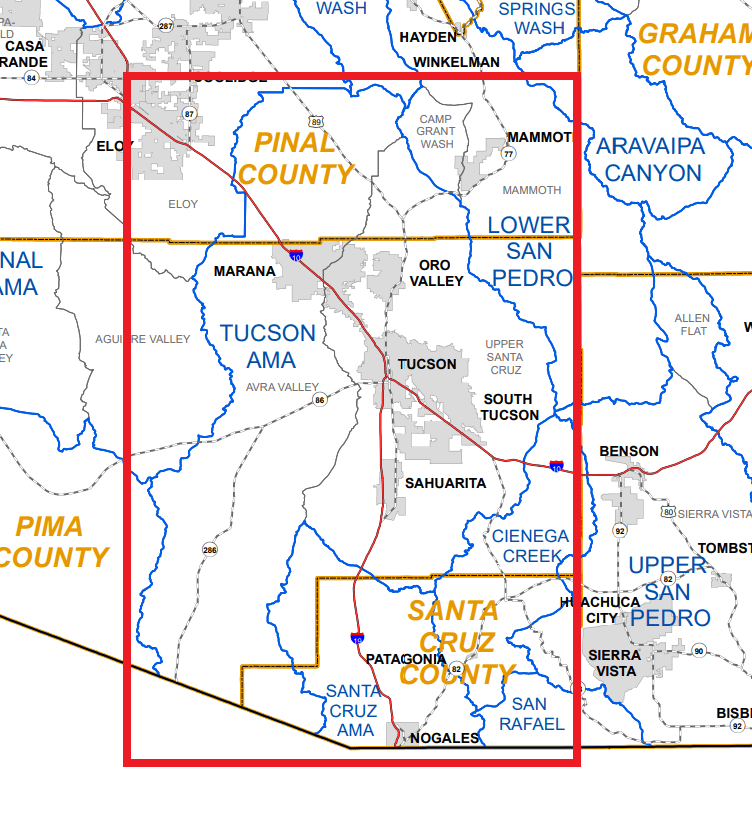
The groundwater subbasins that will be targeted are as follows; Avra Valley, Cienega Creek, San Rafael, Santa Cruz AMA and Upper Santa Cruz. These subbasins cover several thousand square miles of Tucson Metro, farmland, riparian areas, Santa Cruz River and rugged terrain in Southern Arizona along the border of Mexico. Additional coverage areas include the cities and towns of Green Valley, Tubac, Nogales, Patagonia and Sonoita.
For more information regarding this matter, please contact Public Information Officer Shauna Evans at smevans@azwater.gov or (602) 771-8079.
Details about the nature of basin sweeps and groundwater modeling can be found here. If you would like to volunteer your well for participation in this groundwater survey please contact the Hydrology Division at (602) 771-8535.
###
